Another Beautiful Mazatlan Sunday Bike Ride

I ride my bike a lot in Mazatlan. It is a great town for bike riding, at least as far as I’m concerned. Some people are put off by the traffic (pedestrian and vehicular), but I think it adds to the excitement and challenge.

Most people do what I used to do and go up and down the malecon (or boardwalk) along the ocean. It is relatively flat, very scenic and overall very safe. However, it is not very challenging and if you are trying to get in some good cardio or burn a few extra calories, you either tow a bag of bricks behind you or seek a tougher ride.

I started seeking tougher rides nearly two years ago. I started going north to the far end of town, but that involved too much street time and too many crazy drivers. It was all flat other than the two bridges that are more of a workout due to the speeding traffic then the incline or distance. I also have experimented with riding downtown and do still enjoy it from time to time. It is best to go really early and realize that for a great workout, you will be going up and down the same small  hills over and over.

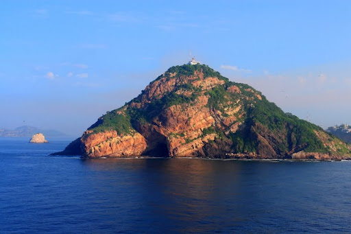
Mazatlan has two big hills – both in the southern part of town, called Olas Altas. Mazatlan also has the second tallest natural lighthouse in the world. So, about six months ago, I decided to combine the challenge of an up and over a good sized hill with a climb to the top of the lighthouse for a good cardio workout.

If you do not know Mazatlan, you can’t imagine what a wonderful ride this is. So today I packed along my camera and took a few pictures in an attempt to show at least some of what I like about this ride. As for the hill, well, I admit it doesn’t look like much in these pictures, but it is a moderate challenge for me and of course is getting easier the more times I go. Try it and see.

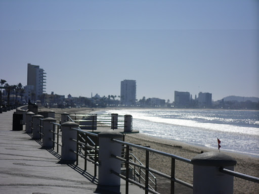
Here is the malecon looking south from in front of our house:

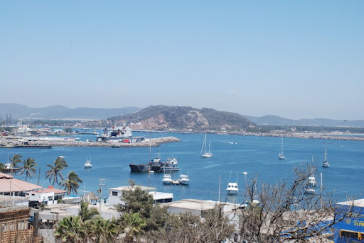
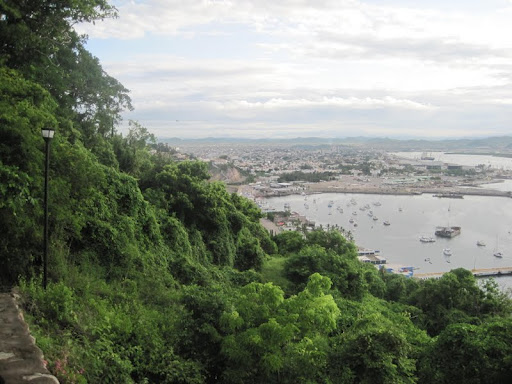
Here you can see the curve of the bay and how flat most of the malecon is:


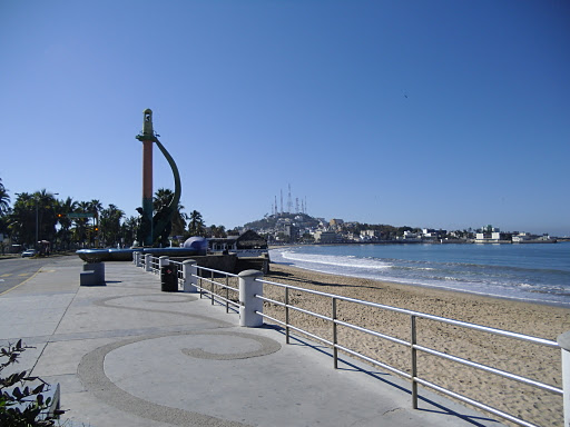
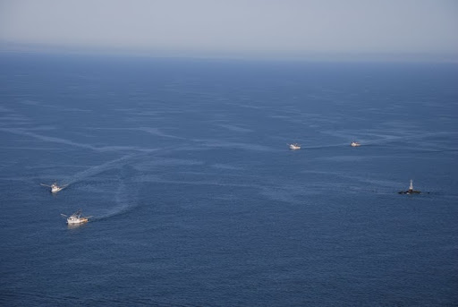
The curve and flatness continue as we go past the Fisherman’s Monument:

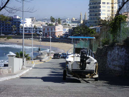
Once we get past the fishing boats, there is a small incline, but not much of a challenge:

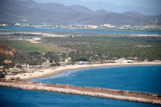
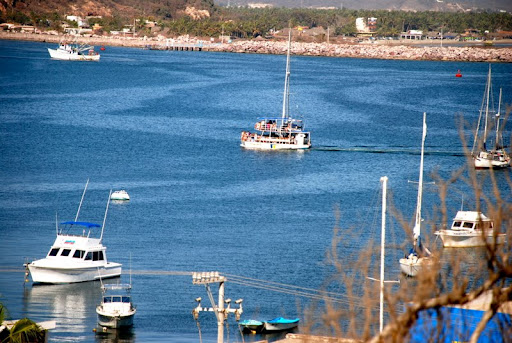
Are you digging the view as much as I am? Can you see why so many people choose to just stay on the malecon? At this point we are directly across from where we live and have gone around the bay. Our building is circled:

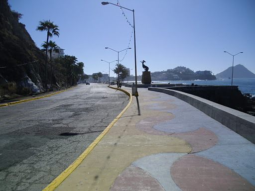
Now, there is another incline in the road to make for a little challenge:

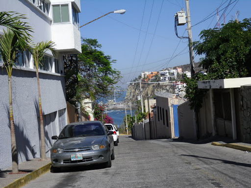
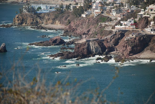
After we round the corner and go past some vendors and the huge flagpole, we begin to see the hill to the right of the statue in the picture below and the lighthouse on the far right:

As we get a little closer, we can zoom in on the first part of the hill that we will need to climb. Today, Sunday, is the easiest day. During the week the school (blue and white building) at the elbow in the road is very busy. The turn is extremely tight and there are cars and kids everywhere. The hill is essentially three little hills in one. We will go straight up towards the school, turn left away from the ocean and then turn right and rise up above and behind the school, before eventually turning right and enjoying the downhill ride to the road to the lighthouse.

Here we are ascending the hill towards the school and a shot looking back from the school:

Next we turn left and parallel the school (hill 2):

From the next corner we pause to look behind us:

And in front of us (hill 3):

It’s at this time that my heart is usually working the hardest. With an allowed maximum heart rate of 170, I am happy to see that I have not overdone myself today:

If you look closely, you can see that we have only been at this for 28 minutes. It’s taking longer to type this than to ride it!

Looking back down hill 3:

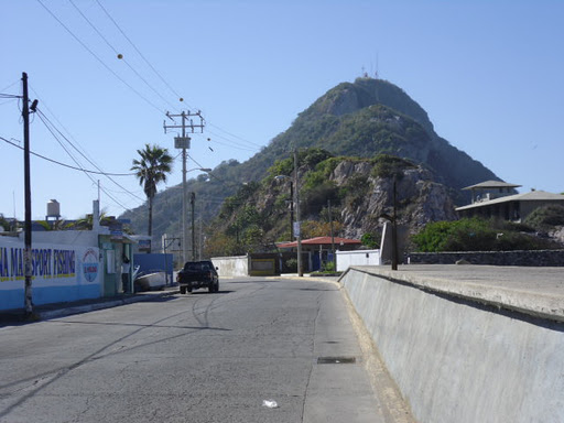
And ahead to the downhill ride the awaiting lighthouse:

The approaching lighthouse and a look back at the fun downhill ride we just had:

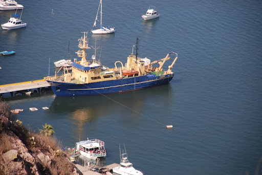
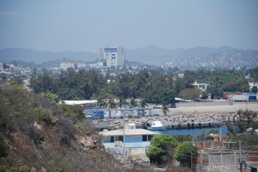
The road to the lighthouse – water on both sides. The lighthouse used to be an island, but a road was built over the rocks to accommodate traffic.

We have written about the lighthouse. You can read that entry here. Some people actually ride their bike up the switch back dirt path and then carry the bike up the stairs (or turn around). What I like to do is tie up my bike at the bottom. Fast walk up the path and 300+ steps, spend two minutes at the top, hurry down the stairs and then run down the path and jump back on my bike. It keeps my heart pounding and takes about 30 minutes depending on how many people I have to get around on the stairs. It is a great workout. My final picture is my bike tied up to a telephone pole waiting for me as I complete my trek down the hill. To get home, I go back the way I came. Total time is usually around 90 minutes, give or take as the wind and stopping to talk to friends often makes a difference.

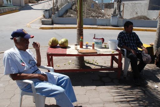
A note about the picture. If you look to the right, you see three people sitting in the middle of the roundabout–one with a guitar. These three guys were sitting there when I got there and when I left just playing music and singing old Mexican ballads (quite well too). Just one of those little treats here in Mazatlan that helps me remember why we moved here.

If you ride a bike here, please be safe. It takes a little getting used to. Most of all be careful and have fun. Enjoy your ride!

El Faro/The Lighthouse

At 160 meters above sea level, the El Faro de Mazatlán is said to be the highest naturally located lighthouse in the world. I don’t know for sure that this is true, but neither can I find evidence to contradict it (see my notes on Gibraltar at the end of this post). What I do know is that a hike up our beloved El Faro hill is WELL worth it. In every season of the year it is gorgeous!

The view from the top of the hill is of course SPECTACULAR. You can look west to the Sierras, out over the city and waterways of Mazatlán, or east to the vast expanse of the Pacific. It’s a great place to sit and have a picnic, and take some panoramic photos of the pristine beaches of Isla de la Piedra while they remain undeveloped.

Your hike up the hill will only take 15-20 minutes. There are plenty of people who run the route. It starts out as a dirt path, and higher up turns into about 300 concrete steps which wind their way around a few switchbacks. Each turn and each elevation provides you a different vantage, and all are delightful. It’s as pretty on a clear day as on the rare cloudy or rainy one.

You’ll see ferries, cargo ships, shrimping boats, fishing boats, party boats, sailboats, and pangas.

You start your hike on the east side of the port. This is where many of the fishing excursions and party boats load their passengers, and there are a few dry docks and boat repair facilities to catch your interest.

At the entrance to the lighthouse walk, at the base in front of the port, is a coconut seller. You might want to join him for some refreshment on the way up or down.

The flora and fauna on your hike will delight your senses. In the early spring the cacti bloom. The green contrasting with the brilliant blue of the ocean will make you so glad you came! In just about any season of the year you’ll see something flowering.


We climb the lighthouse hill at least once a week, we enjoy it that much. Two weeks ago I told everyone we were “Wasting Away Again in I-gu-a-na-ville,” because we saw at least eight different iguanas sunning themselves during our climb to the top. We saw lime green, deep green, yellow, orange, brown and black iguanas.

This week I had to change that to “Arañaville,” as the spiders were out spinning their webs in whatever direction you cared to look. It was incredibly gorgeous!

Along the route people have graffitied the stairs. Near the top of the stairs is one of my favorites: a Spanish lesson. It teaches the difference between “top” and “abyss,” which sound similar in Spanish (or at least the Mexican version of the language).

Once you reach the top, and after you take in the view to your heart’s desire, there is also a trail that takes you down behind the lighthouse, on the other side. There are several resting places, and a steep climb involving rope at one point that leads down to the water.

Here you can see our much-worshipped cervecería, the Modelo beer brewery, from lighthouse hill.

NOTE: The highest lighthouse in the world, some have told me, is the Europa Point lighthouse on Gibraltar. However, though the Rock of Gibraltar is 426 meters high, the lighthouse is located on the waterfront, not the top. There is only an aviation beacon at the top of the Rock of Gibraltar. Thus, I’m not sure how our local El Faro ranks globally. It may indeed be the highest.

Caimanero & Walamo: Day Trip from Mazatlán

Though Danny’s been in school a week already, tomorrow is the “official” first day of school. He took off with a bunch of friends to Isla de la Piedra, so Greg and I figured we should head out for a day trip as well. Where to go? We’ve been wanting to get back to Cosalá, but since it was already late by the time we were ready to leave that seemed too far to go.

We hadn’t been to Caimanero in a while. How about some zarandeado? Yeah! Even in the heat of summer, the beach has a nice breeze, so as long as we’d be under a palapa at one of our favorite restaurants, fresh fish, a gorgeous drive and an incredible view sounded great!!!!The drive to Caimanero is super easy and very scenic. You basically only make one turn, through Walamo, to get to Caimanero from Mazatlán. The drive is very relaxing, with lots of rural vistas and small town scenes. Estuaries with waterfowl (cranes, storks…), beaches and palm trees, mountains, and aguaculture farms (both shrimp and fish).

We left at 11:30, we were home by 6:00, we stopped a dozen or more times, and we ate a very leisurely and delicious lunch that only cost us 250 pesos with tip for two people with beer. Get your day trip gear on and take a trip, people! Enjoy! Be sure to watch the slideshow below to see just how incredibly lucky we are to live in Mazatlán, with so much to offer in the city and nearby.

Desfile Semana de la Moto 2011 / MotoWeek Parade

This is our third Moto Week parade. It was much lower key than other years–fewer people, less organized. The parade lasted at least two hours. We LOVED it. Time to sit back in our chairs, sip a soda or beer, look out over the ocean and the incredible sky, and thank God that we are able to live in Mazatlán, amidst so many fun-loving people.

There are lots of photos in this album (130 or so). It’s really fun. So, please, pour yourself a cup of something, sit back, and enjoy… Join us next year!